Lake Onega petroglyphs: ancient images by the water
Birds, animals and unusual figures on the eastern shore of Lake Onega in the Pudozh area.
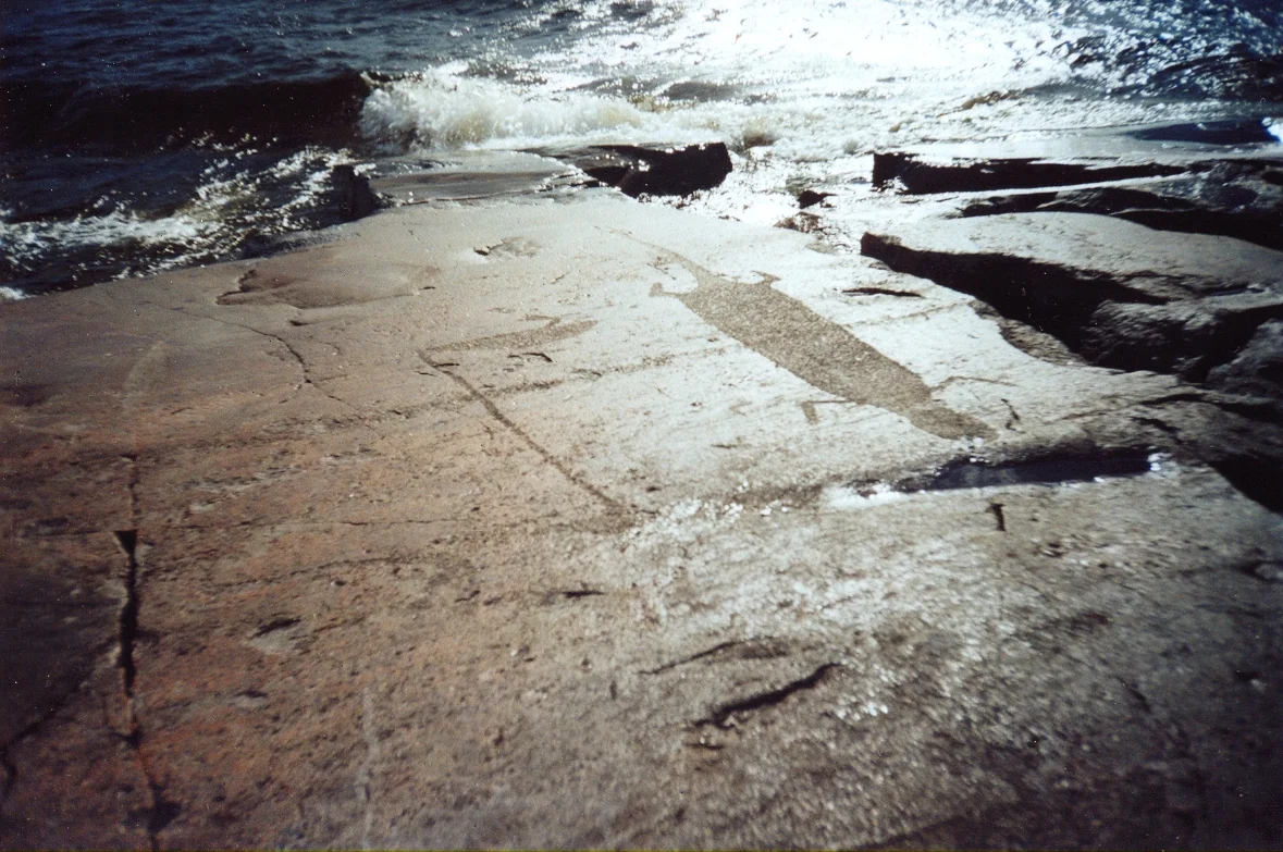
The shoreline is part of the story
The Onega carvings make more sense in their original setting. Horizontal rock surfaces, water and open space provide a scale that an isolated photograph cannot convey. These Neolithic images remain within a natural landscape, making a visit both an encounter with archaeology and an opportunity to observe the lakeshore.
What to look for
UNESCO identifies birds, animals, figures combining human and animal features, and geometric shapes. Some signs may relate to celestial bodies, although interpretation requires care. Compare neck shapes, bodies and the arrangement of figures: even without specialist training you can notice repeated choices made by the people who carved them.
Two components, two journeys
The Onega and White Sea components share World Heritage status but lie far apart. Pudozh is a natural starting point for eastern Onega, while Belomorsk belongs to a different travel area. Their shared heritage name should not be mistaken for a compact walking itinerary linking both sites.
Access and weather
Before booking accommodation, identify the exact group you want to see and the permitted approach. Confirm the final access section, any boat transfer and guiding arrangements for that route. Weather affects travel on open water, so allow spare time. An overview map point does not identify a landing place.
A careful visit
Do not use the rock for drawing, fires or improvised restoration. Photograph the setting and details from permitted positions, then discuss uncertain figures with a guide. Vodlozero offers another perspective on eastern Karelia, although a water journey in the national park needs its own preparation and itinerary.
Location
Reference coordinates: 61.6739, 36.0294
Reference point on an overview map. It is not an approach track, landing site or confirmation of access. Check the actual entrance with the host organisation.
Show on map ↗Visitor impressions
Reviews are loading.
By interests
Explore further
Pudozh
An ancient city on the Vodlia River, east of Lake Onega.
CultureWhite Sea petroglyphs
Rock carvings near Belomorsk: hunting, boats and traces of ancient northern communities.
NatureVodlozersky National Park
A natural and cultural destination in eastern Karelia, best planned as a journey of its own.
Sources and verification
Sources checked: . Check the applicable conditions before travelling.